Glendermott Presbyterian Church
Welcome
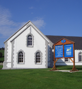
Glendermott Presbyterian Church is situated on the outskirts of Londonderry approximately two minutes from Altnagelvin Hospital. The congregation was established in 1654 and thus have enjoyed over 350 years of God’s goodness and provision. The original church was located further up the valley than at present, however, the congregation has been able in 1996 to celebrate 300 years at the current site.
What’s on and When
Throughout the week the church offers a wide and varied programme of activities to suit all age groups. Many of the activities have closed for the summer months but we look forward to welcoming you come September. Plan to attend!
Monday
Girls Brigade Explorers (Age 3 – P4) 6.30pm – 7.30pm
Girls Brigade Company Section (Primary 5+) 7.15pm – 9.00pm
Presbyterian Woman (1st Monday each Month) 8.00pm
Wednesday
Mother and Toddler Group 10.00am – 11.30am
Curling Club 11.00am
Bible Study 7.00pm – 8.00pm
Bowls Club 8.00pm
Thursday
Boys Brigade Anchor Boys (P1 – P4) 6.00pm – 7.00pm
Boys Brigade Junior Section (P5 – P7) 7.00pm – 8.30pm
Boys Brigade Company Section (Yr8 and older) 8.00pm – 10.00pm
Needlecraft (3rd Thurs each month) 7.30pm
Friday
Youth Club (Secondary school age) 7.30pm – 10.00pm
Sunday
Prayer meeting 9.30am Sunday School Primary, Junior, Senior & Bible
Class 10.30am – 11.15am
Morning Worship 11.30am – 12.30pm (Creche & Childrens Church
Available)
Media files
Recordings of the Sunday services available on our Youtube channel
Find Us